How to drill
an ice shelf
— and why
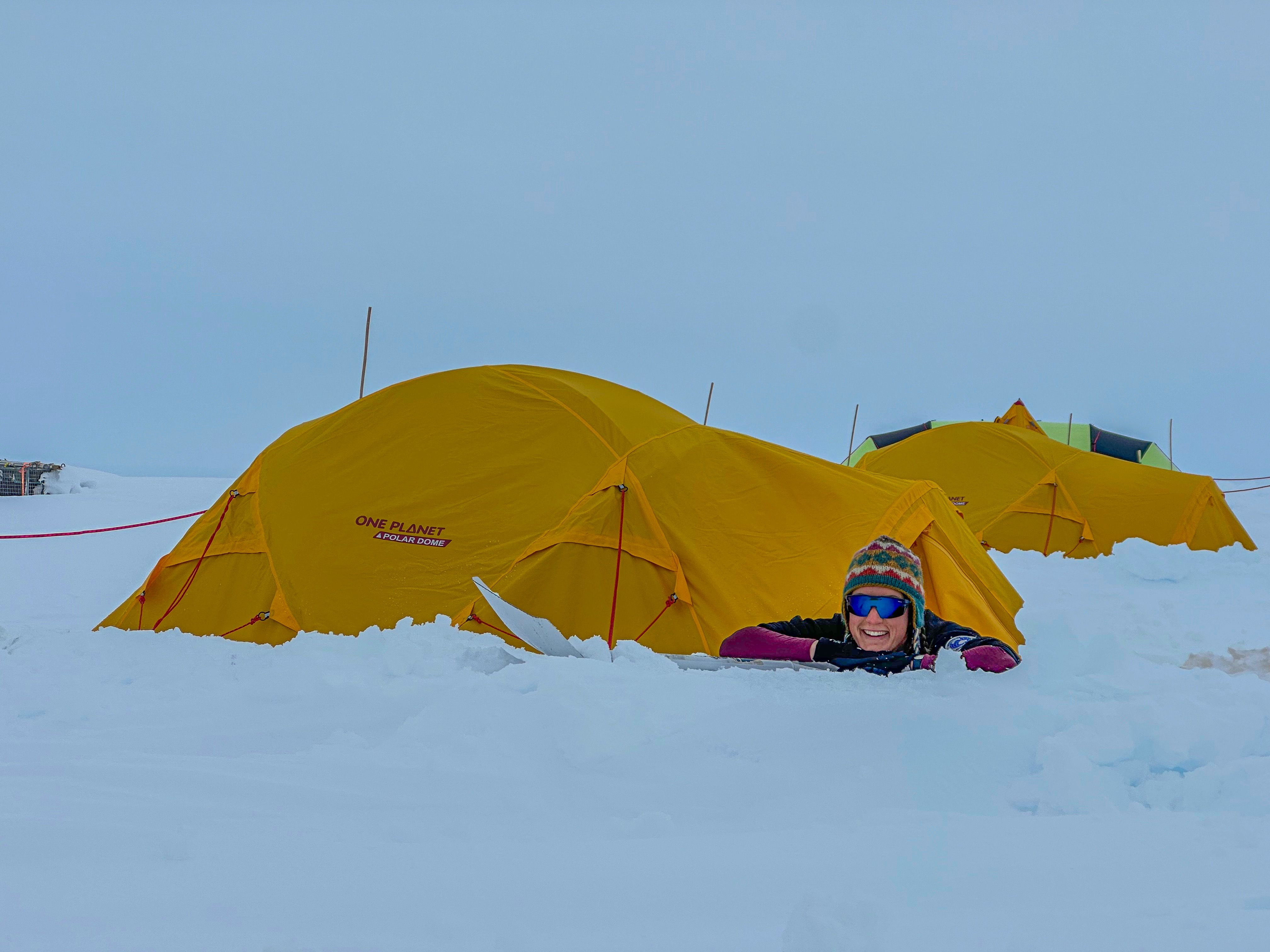
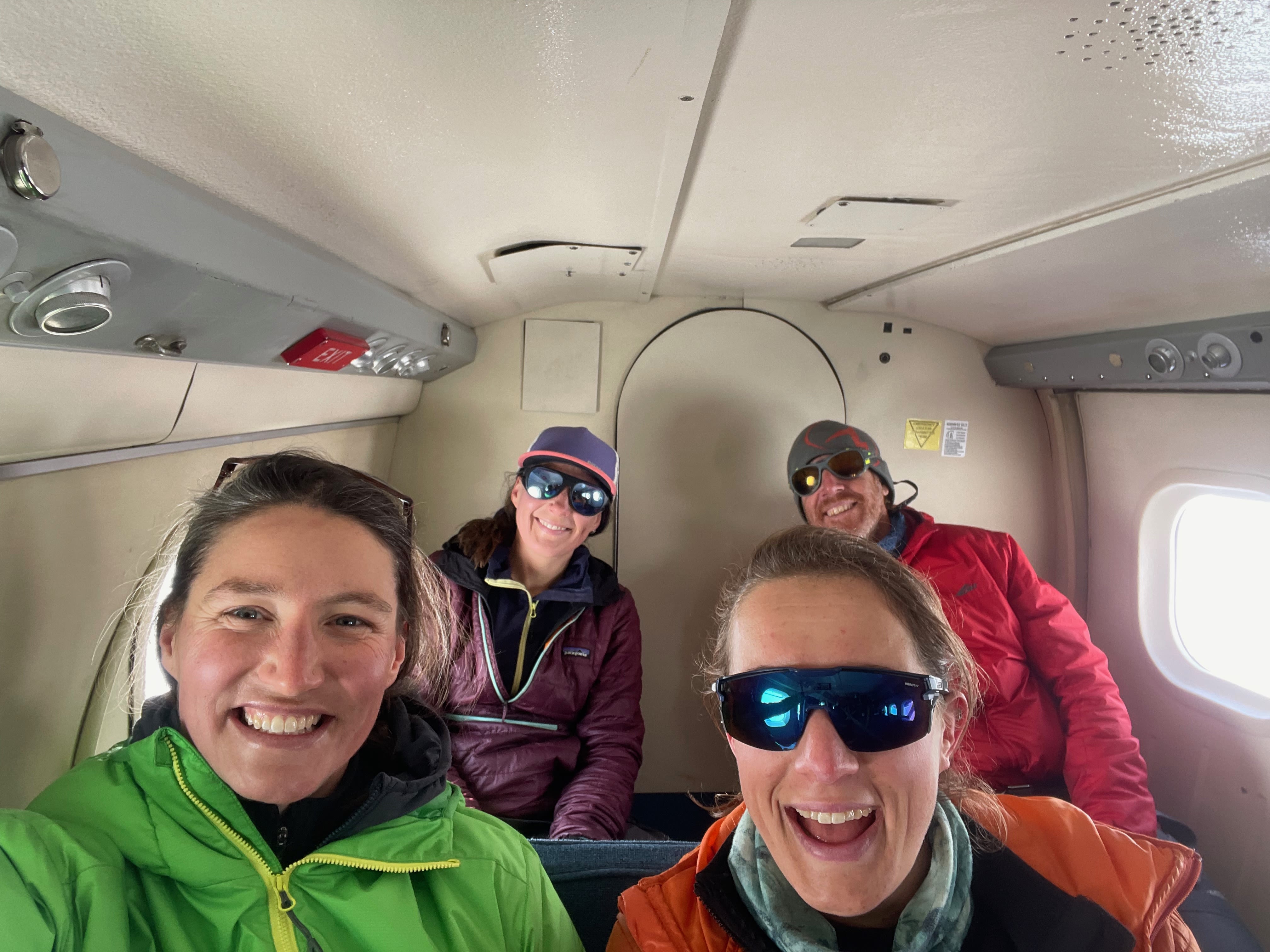
Christmas Day 2023. While many of us are at the beach or around the barbie, a plucky team of four scientists and a polar field guide pitch their tents at what must be the world’s most remote campsite: the Shackleton ice shelf.
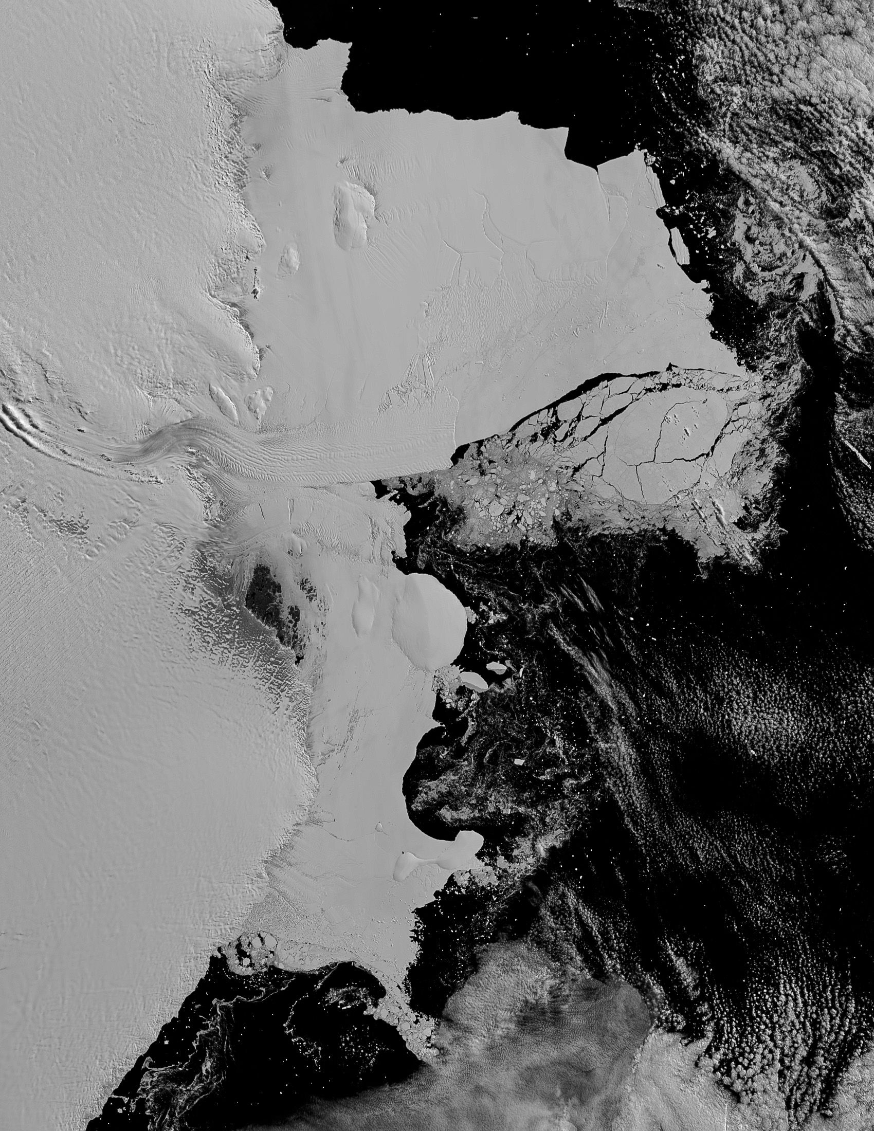
Almost nothing is known about this massive system of interlocking ice shelves and glaciers in East Antarctica, around 5,000 kilometres south of Australia.
Ice shelves are floating edges of the ice sheet that fringe three-quarters of the Antarctic coast. They act as ‘seat belts’ to restrain ice on land from flowing into the sea and causing sea level rise. Without them, glaciers could slip into rapid retreat.
This is the story of how (and why) Sarah, Madelaine, Katie, Duanne and Nick drilled a hole through the Shackleton ice shelf to reach the ocean — and what they found beneath.
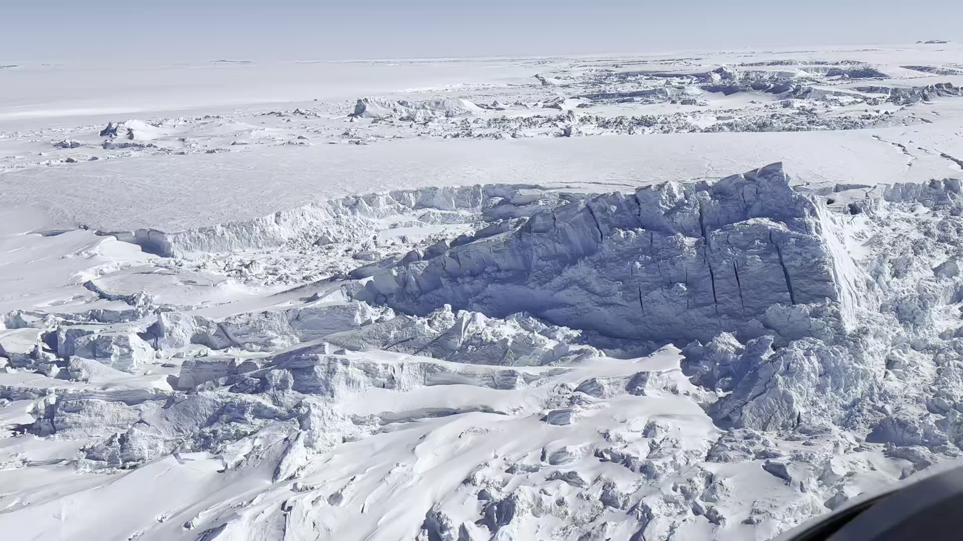
Antarctica’s ‘soft underbelly’
The Antarctic Ice Sheet holds 70% of Earth's freshwater and 90% of our planet’s ice.
The kilometres-thick dome of frozen snow flows inexorably to the sea through glaciers.
Suspended in that ice sheet, if it all melted, is about 58 metres of potential sea-level rise.
Most of Antarctica’s ice is stored in the East Antarctic Ice Sheet, with enough to raise global sea level by around 52 metres — over four times greater than both Greenland and West Antarctica combined.
Antarctica’s coastal fringe is its key point of vulnerability. This is where the floating extensions of the land ice, known as ice shelves, buttress the ice sheet on land and slow ice flow into the sea.
But if ice shelves are eroded by warmer waters, they can melt and disintegrate faster, allowing the flow of land ice into the ocean to accelerate.
Ice shelves are Antarctica’s soft underbelly, their stability at the mercy of changes in the Southern Ocean.
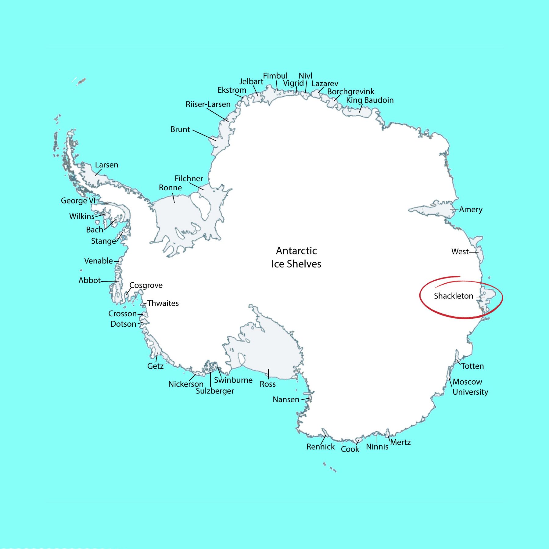
The Shackleton 'seat belt'
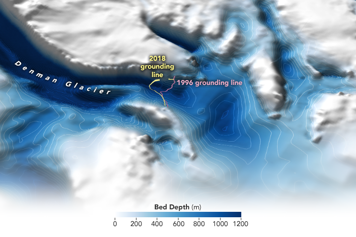
The 110-kilometre-long Denman Glacier drains a vast area of the East Antarctic Ice Sheet.
Before it reaches the sea, the Denman Glacier flows through a canyon about 3.5 kilometres below the surface, making it the deepest known glacier on Earth.
This is largely unknown territory.
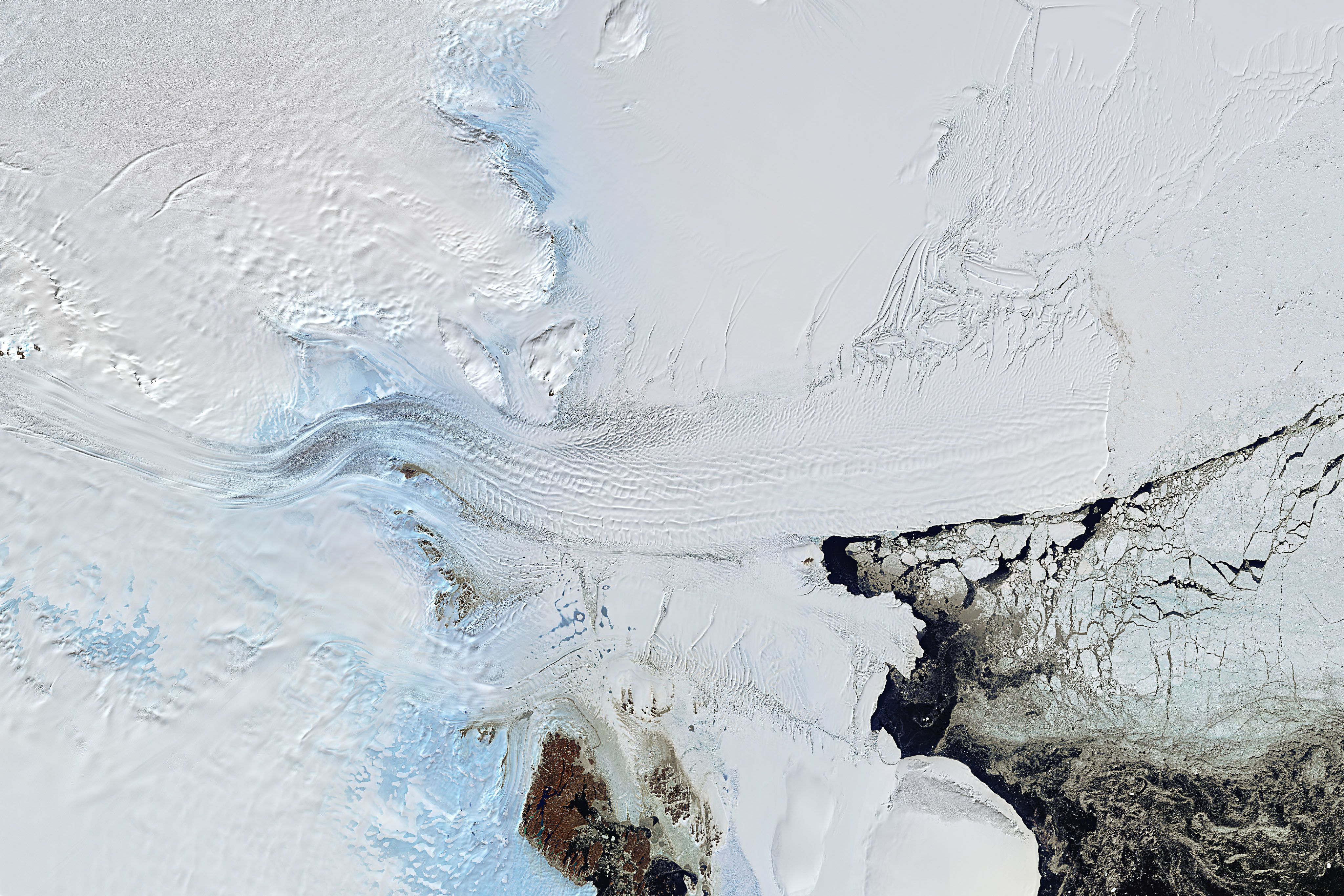
The Denman Glacier tongue floating on the ocean is surrounded by the Shackleton ice shelf.
At about 34,000 square kilometres, the ice shelf covers more than half the area of Tasmania.
The massive Shackleton ice-shelf system is a traffic jam of smaller glaciers and ice tongues that slows the flow of ice from the interior to the ocean.
Shackleton is the most northerly ice-shelf system outside the Antarctic Peninsula.
So the discovery of Antarctica’s deepest subglacial trough beneath the Denman Glacier — combined with high melting rates and the southward advance of warming ocean waters — raises alarm bells about its vulnerability to accelerating retreat.
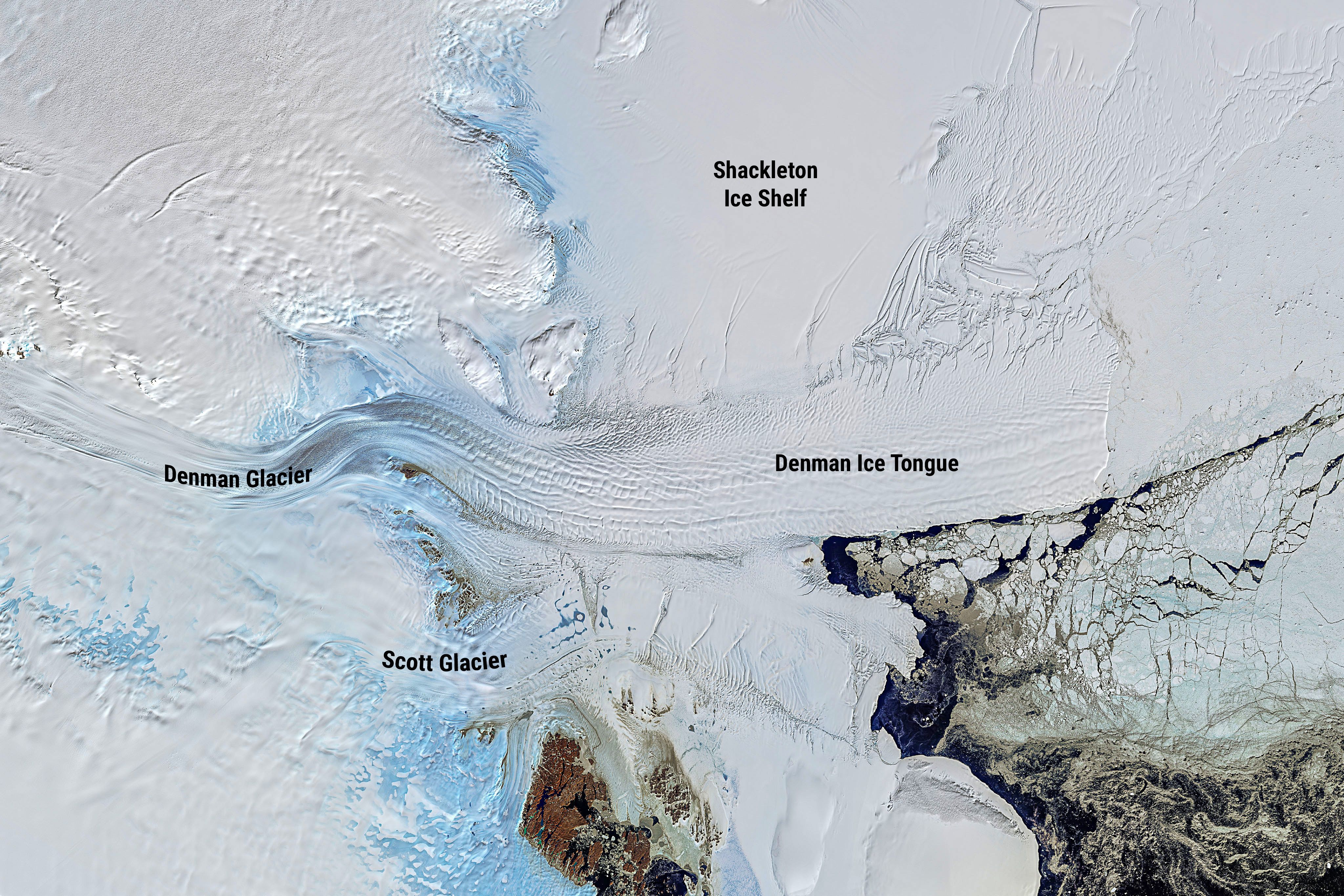
The Denman Glacier is already one of the fastest retreating glaciers in Australian Antarctic Territory.
If the Denman system were to collapse entirely, it alone could contribute around 1.5 metres to global sea level rise.
Meet the crack team
The fate of the Denman glacier depends a lot on the future stability of the Shackleton ice shelf. Knowing more about the oceanographic conditions under the ice shelf will improve predictability of the emerging risks from warming waters.
That’s the point of this mission, says glaciologist and team leader Dr Sarah Thompson of the Australian Antarctic Program Partnership at the University of Tasmania.
“Before we went to the ice shelf, we didn’t even have much of an idea how deep the ocean floor was.”
“Although critical to understanding ice shelf stability, measurements underneath ice shelves are very difficult to get and therefore rare.”
Which is why oceanographer Dr Madelaine (Madi) Rosevear from the Australian Centre of Excellence for Antarctic Science (ACEAS) and the University of Melbourne is part of the team.
“Most of my experience collecting ocean data has been working through holes in sea ice or ice shelves, which has unique challenges, like the tendency for ice to affect sensors in weird and wonderful ways.”
“There are only a handful of measurements of the ocean beneath ice shelves in Antarctica, and none for the Shackleton ice shelf.”
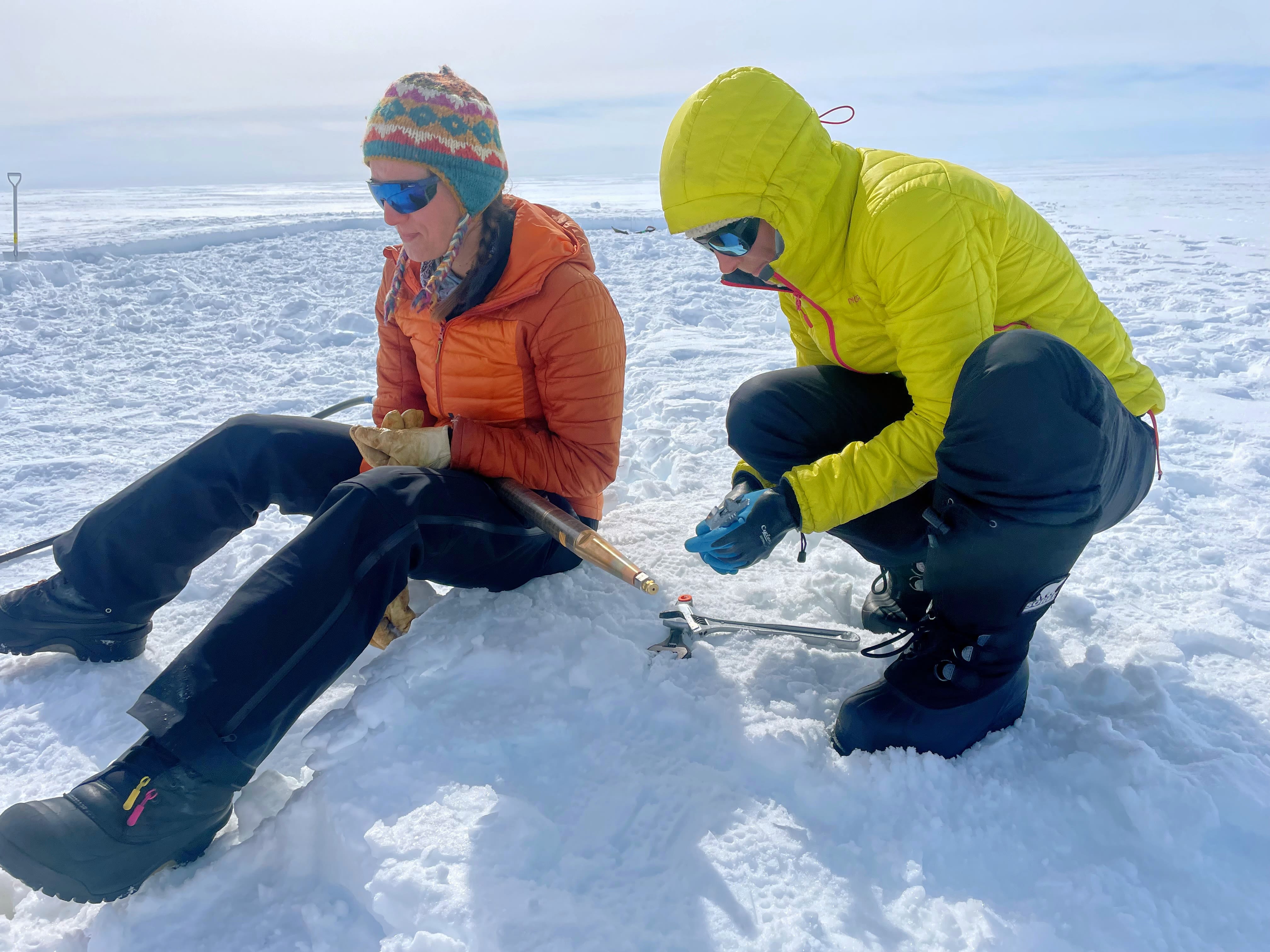
Glaciologist Dr Katie Miles from Lancaster University has experience in driving the drill technology that uses hot pressurised water to melt a hole through the ice shelf.
Katie Miles (photo: Sarah Thompson)
Katie Miles (photo: Sarah Thompson)
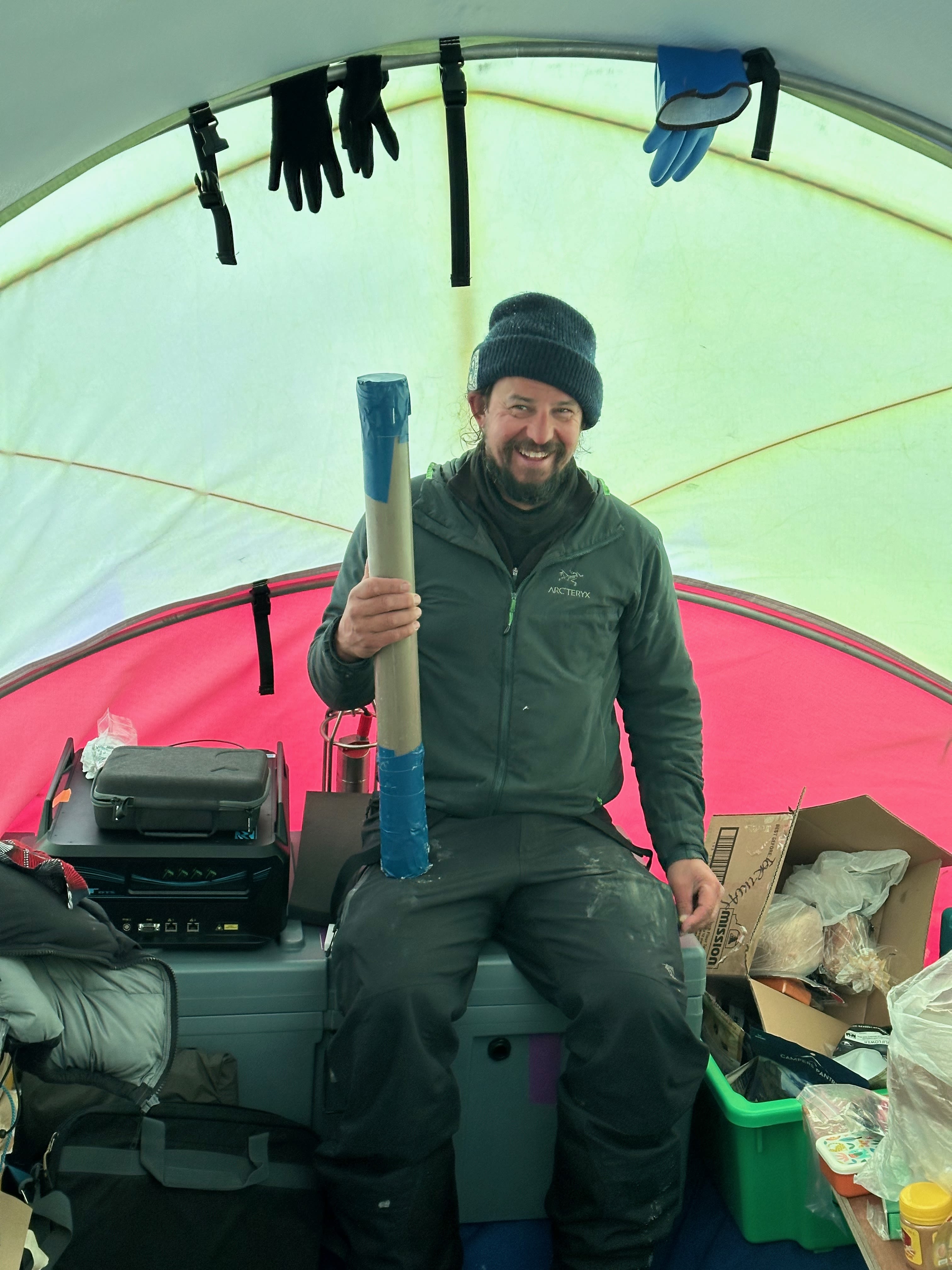
Associate Professor Duanne White is a geomorphologist from the University of Canberra who analyses sediment from the sea floor to interpret the past — and potentially future — behaviour of the ice sheet.
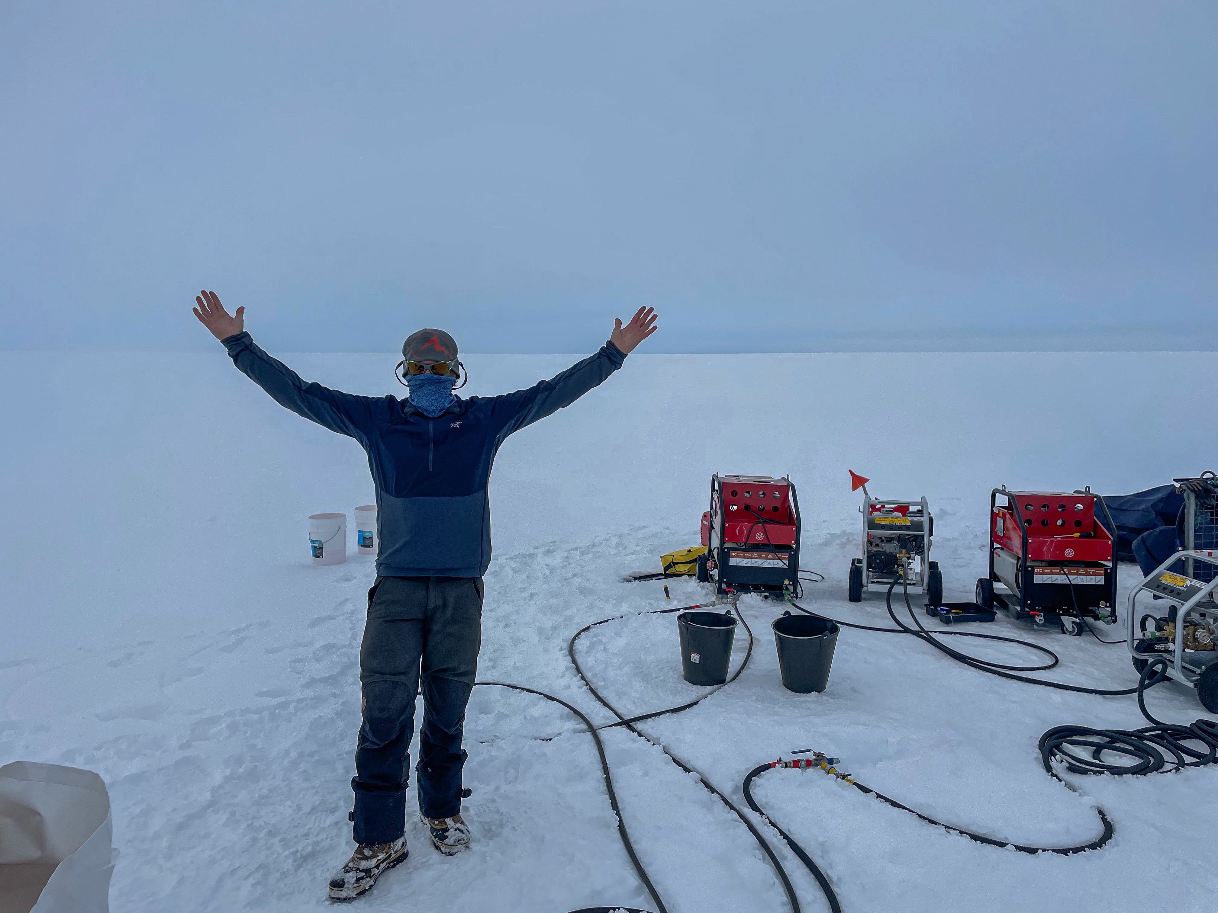
As an experienced polar field guide, Nick Morgan from the Australian Antarctic Division is central to getting the work done safely and efficiently. He does a lot of the digging, drilling and refuelling as well as helping with the instrument deployments.
Nick surrounded by pumps (photo: Sarah Thompson)
Nick surrounded by pumps (photo: Sarah Thompson)
Life on the ice
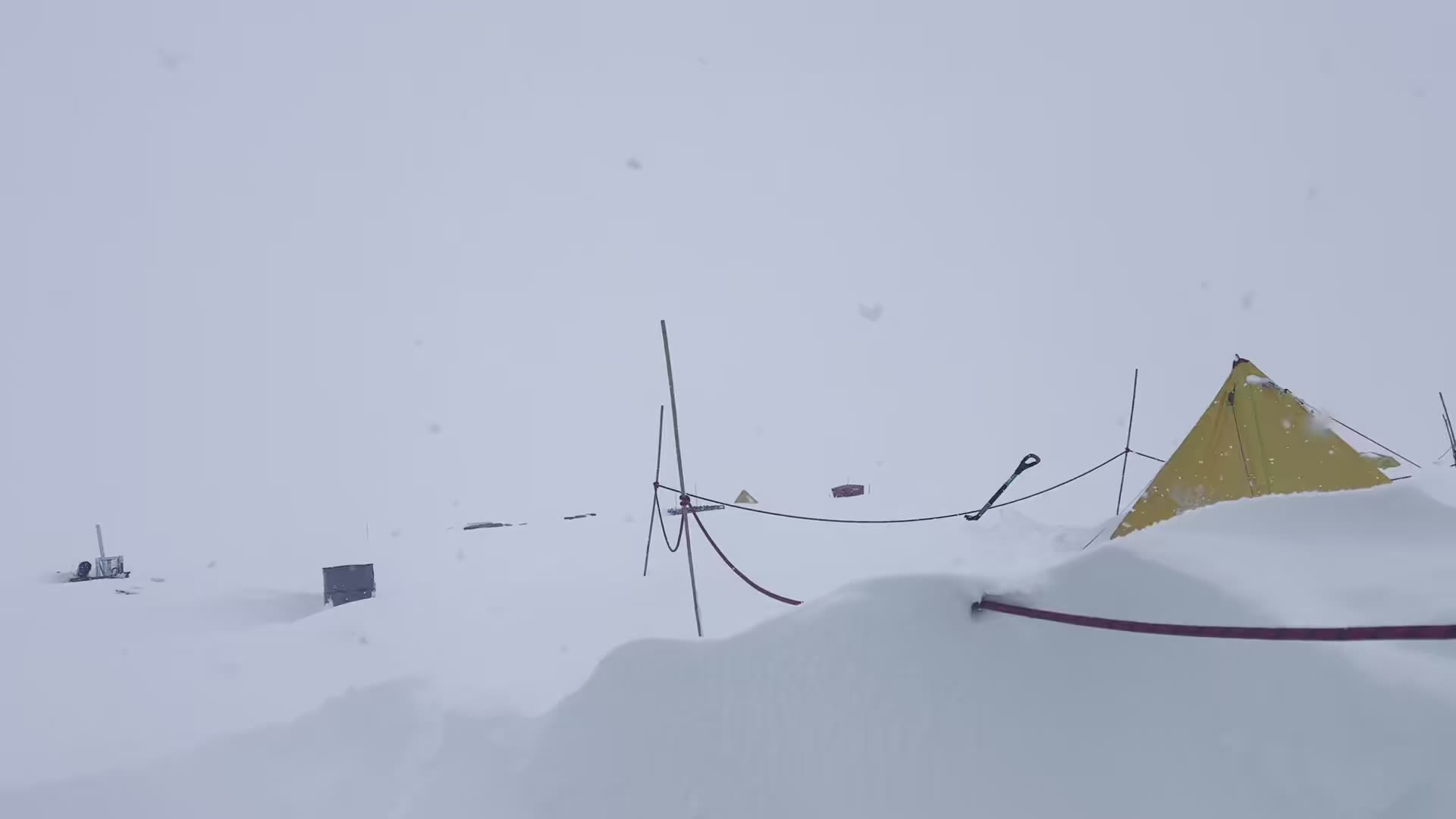
The team lived in their field camp on the Shackleton ice shelf for four weeks.
“Camping on an ice shelf is always an incredible and sometimes surreal experience. Every now and then you look up and remember just where you are,” Sarah says.
“Nobody has ever been here before, let alone camped here for a month.”
“All of the things that people think will be challenging — like no showers, having to melt all your water for drinking and having a bucket for a toilet — very quickly become routine.”
One of the main challenges, says Sarah, is that the longer you camp in a particular place, the more the snow melts underneath you.
“This doesn’t happen in a uniform way and so every single surface is at a different angle. You have to be careful that your morning coffee doesn’t slide off the table, and using the toilet bucket definitely required more balance later in the season.”
Life at Camp Shackleton was dominated by wind and snow.
“We had several blizzards where we needed to dig out all of the tents multiple times a day and then excavate all of the equipment before we could start drilling again,” sighs Sarah.
Madi brought to camp what she describes as a “generic Antarctic fieldwork skill set.”
“Things like knowing good knots, creative ways of shifting heavy objects, cold and fatigue management, and a good sense of humour."
Digging tents out after another heavy snowfall (photo: Sarah Thompson)
Digging tents out after another heavy snowfall (photo: Sarah Thompson)
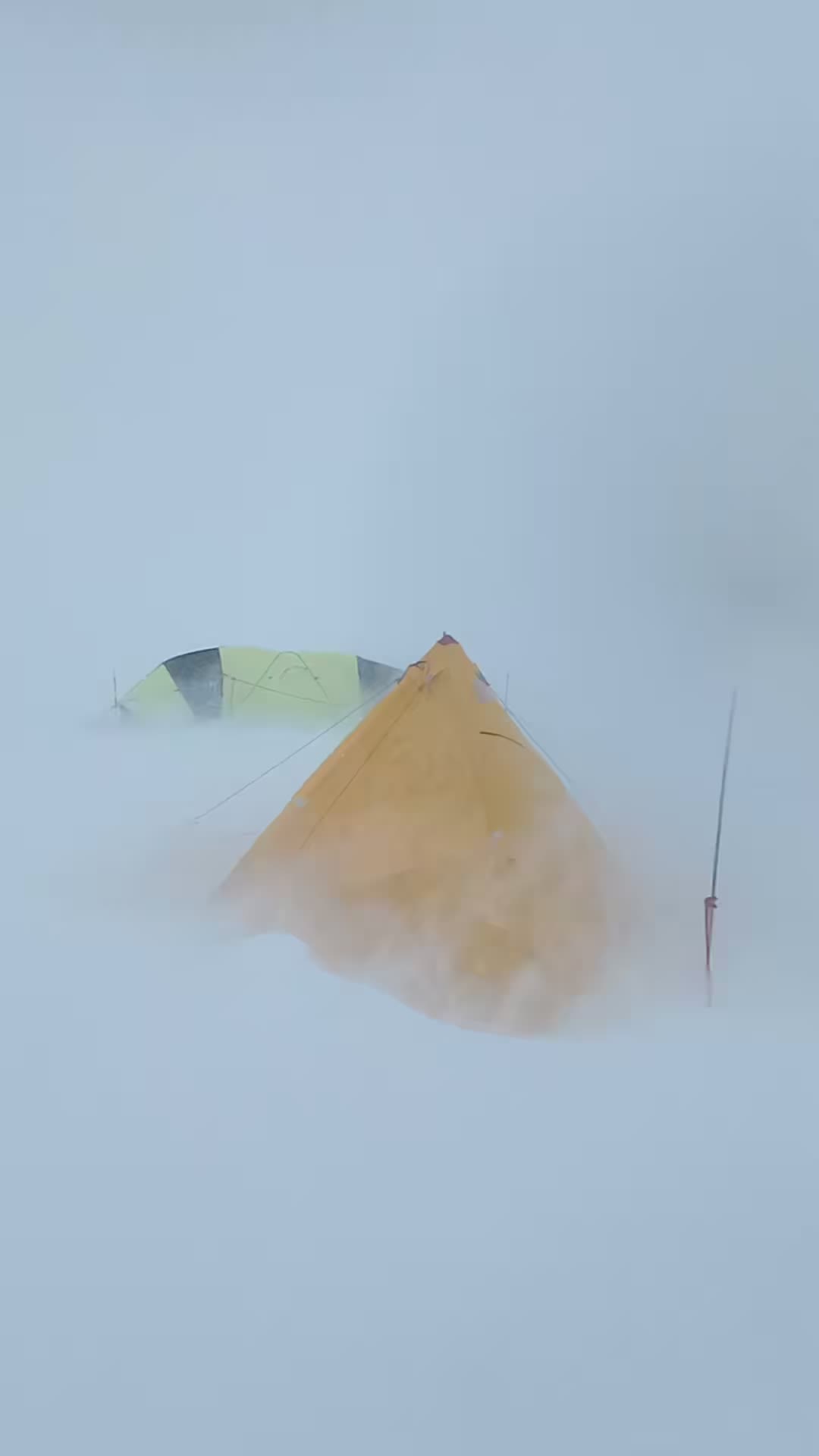
Madi is snowbound
Madi is snowbound
The gentle art of
hot water drilling
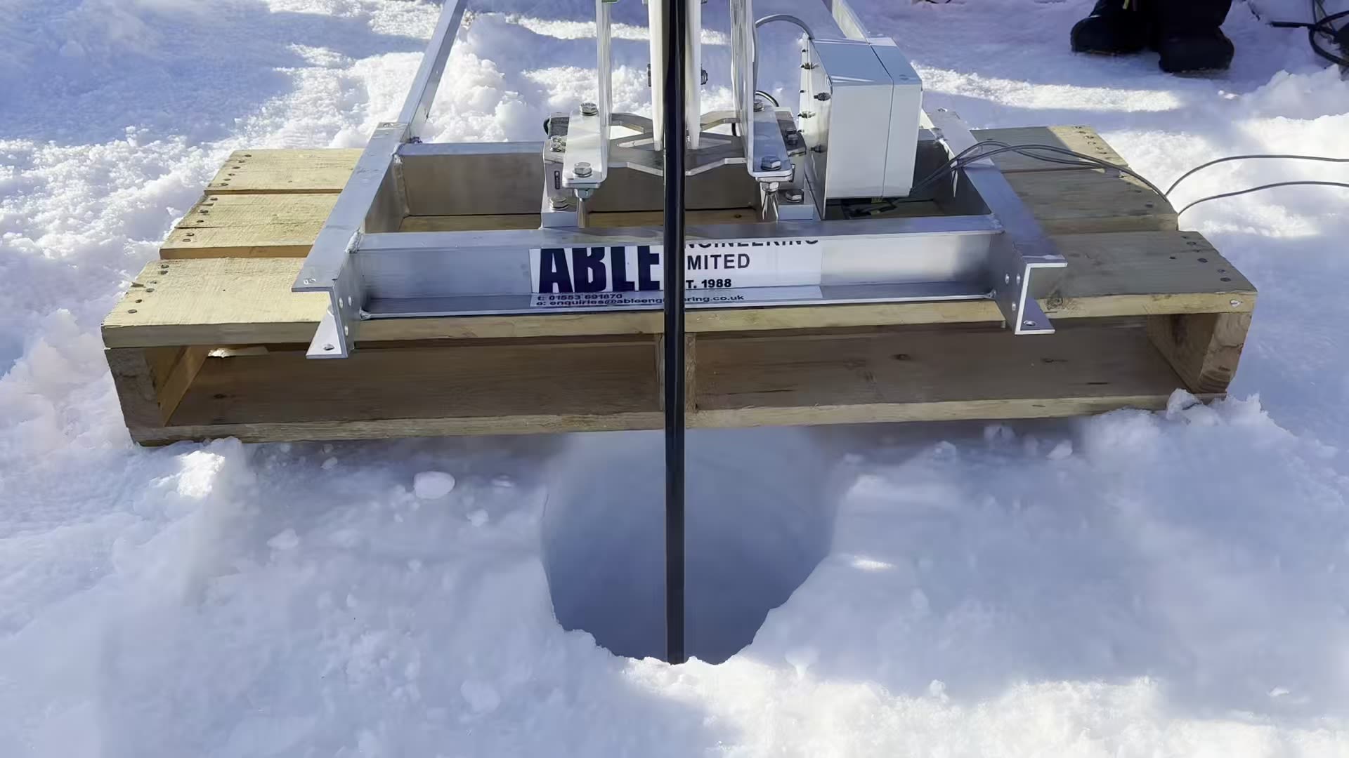
First job was to find a safe place to camp and the right site to drill.
That meant no deadly crevasses on the surface or at depth, with ice no thicker than 200 metres, over at least 800 metres of ocean.
Radar surveys from helicopter and by sled helped the team pinpoint the ideal location.
Katie tows a sled-mounted radar
Katie tows a sled-mounted radar
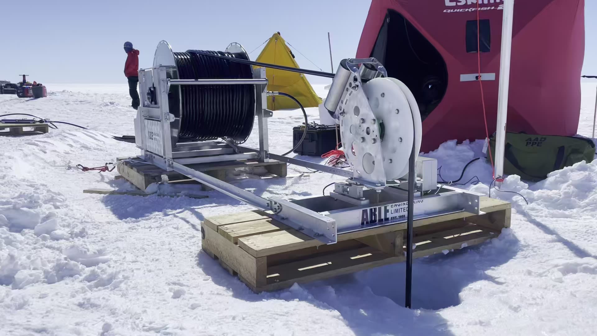
Then came the drill itself.
“The main ingredient in hot water drilling is water,” says Sarah. “But there is a distinct lack of it on the ice shelf.”
“We needed to melt snow, about 60,000 litres of it. All of this had to be shovelled into the water tank.”
And that meant shovelling snow up to 12 hours a day. It took about two days cutting blocks of snow to fill a large ‘onion’ tank that holds 10,000 litres.
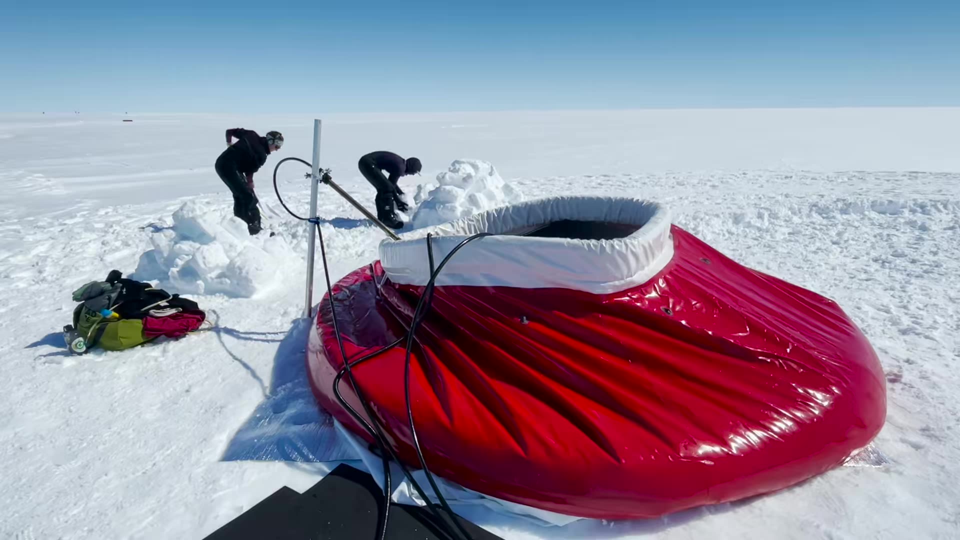
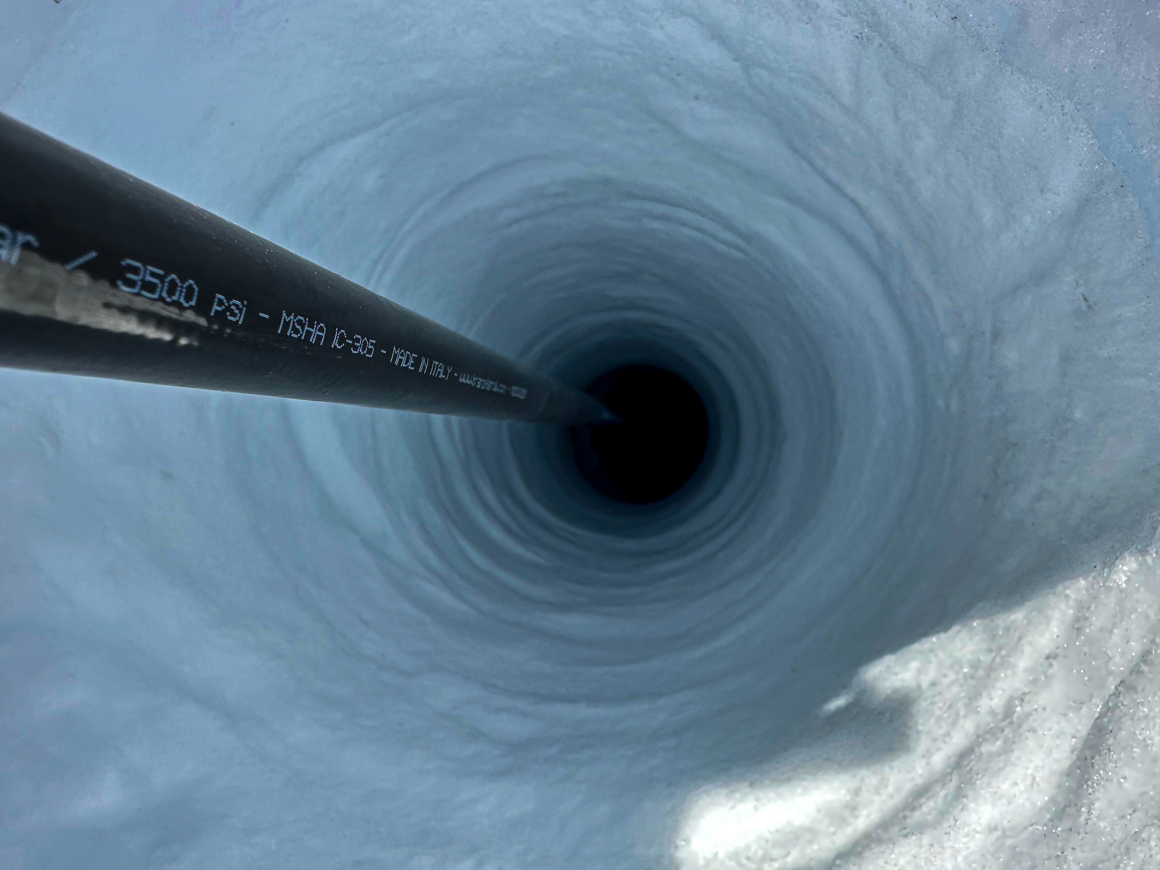
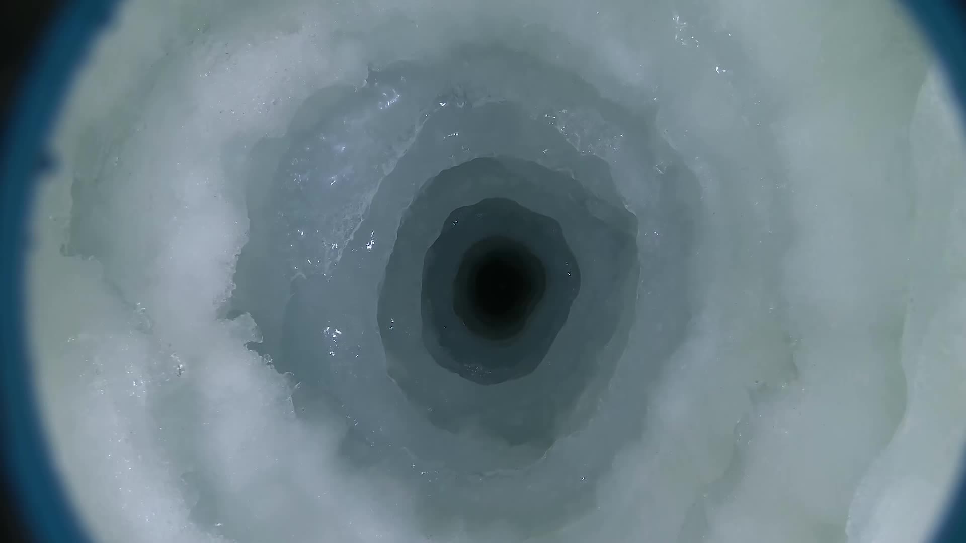
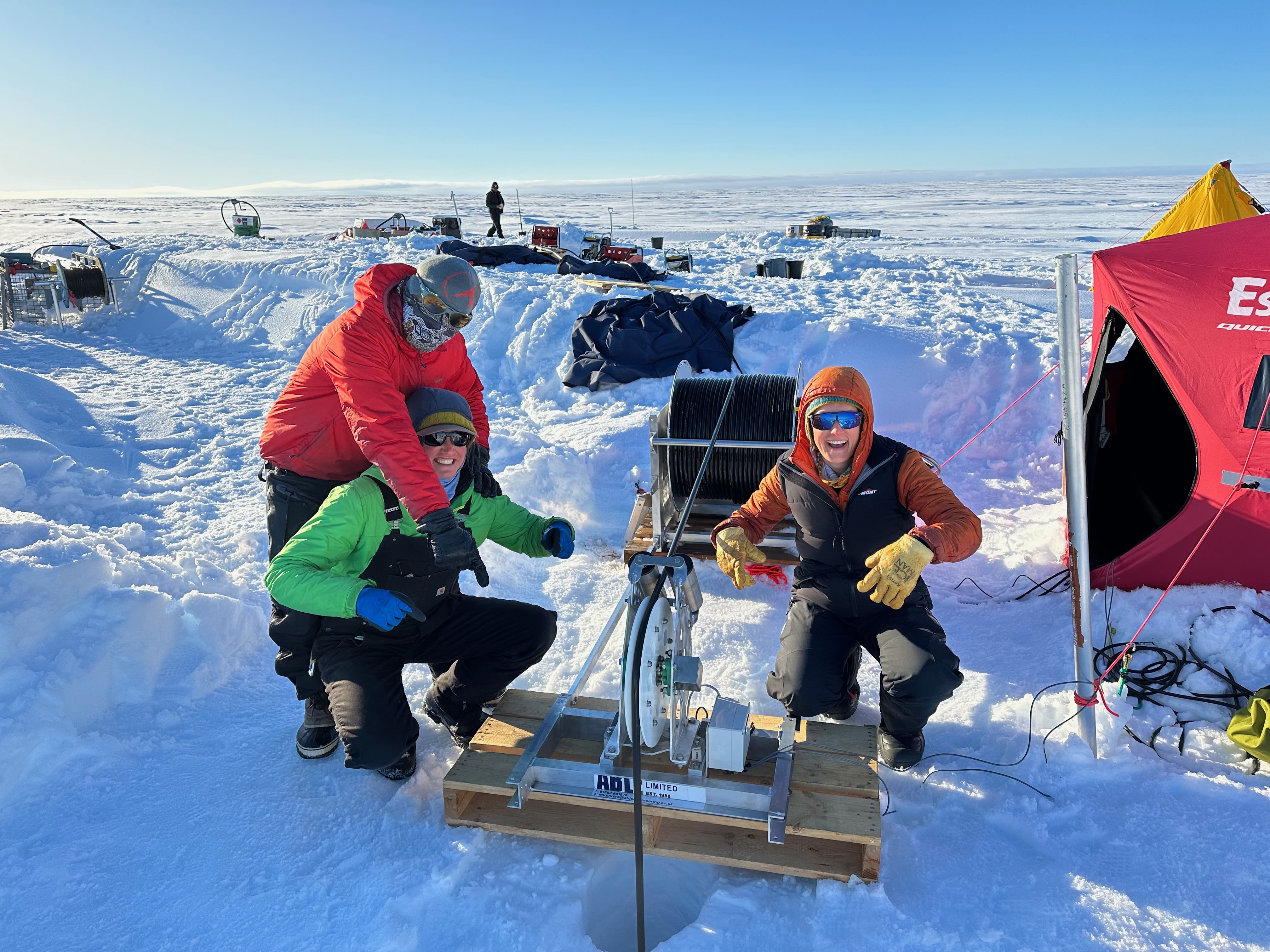
The meltwater is heated to about 75°C, pressurised, and pumped into the drill system. The ‘drill’ is really a hose with a long heavy nozzle that sprays hot high-pressure water to bore a hole as it’s slowly lowered into the ice.
Katie and Sarah prepare the nozzle (photo: Madi Rosevear)
Katie and Sarah prepare the nozzle (photo: Madi Rosevear)
Madi says the practical challenges are many.
“You have to be careful that none of the pumps, hot water heaters, or hoses freeze up, as that would be game over. Since the drilling is done in stages, this means a lot of time spent draining hoses and preparing machines with anti-freeze for the night.”
“Another big challenge is keeping the borehole open and wide enough to send our instruments down and back up again safely. The hole is filled with mostly fresh water from the melted ice, and as soon as you stop drilling it starts cooling down, then freezing up again.”
“Because of this, we typically only had a window of a few hours after drilling and reaming to collect samples and make measurements.”
Larger-scale drilling campaigns can have larger teams that operate around the clock in shifts. For this small team the pressure was on to reach depth and gather data before the hole narrowed, putting their instruments at risk.
While helping out on previous drilling campaigns, Sarah says this was the first time she was responsible for purchasing and putting together a hot water drill system.
“It was a very steep learning curve, but I had a huge amount of help and now know more about plumbing fittings and hydraulic hose than I ever imagined was possible.”
Discoveries under the ice
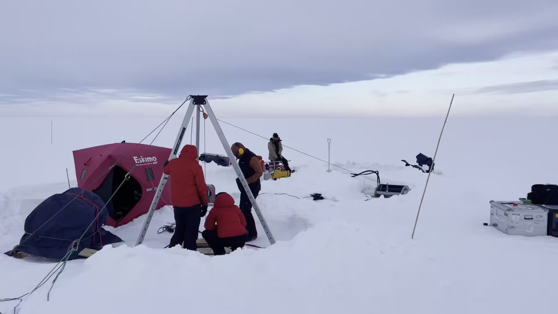
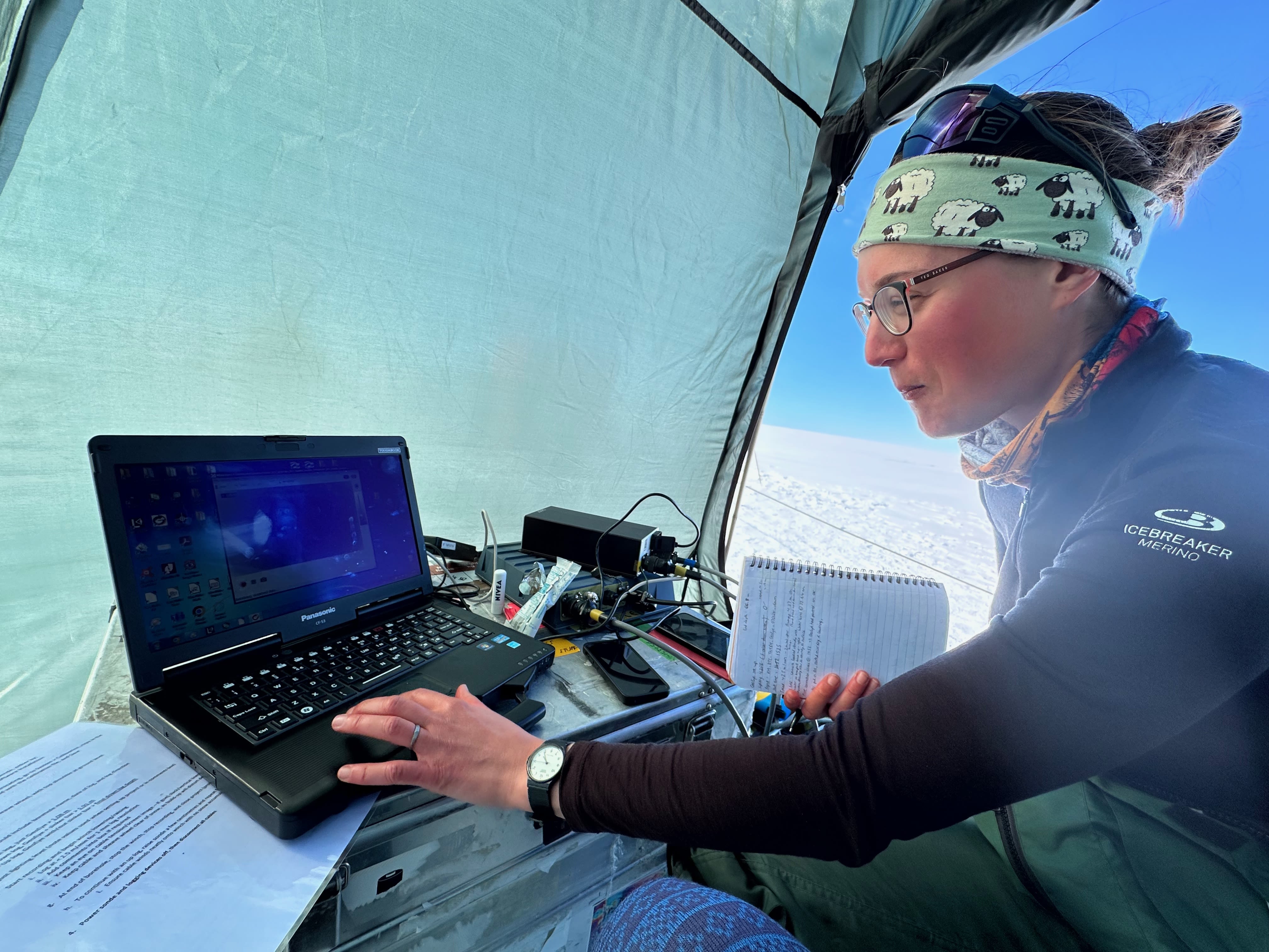
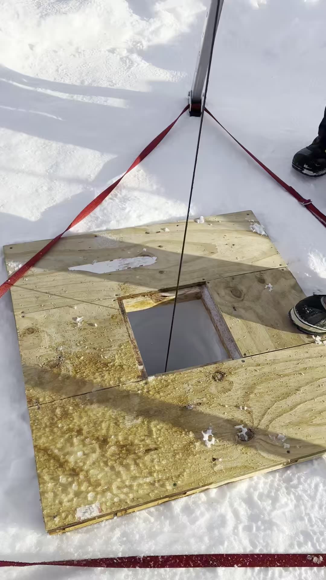
After 30 hours of drill-time over seven days, the bottom of the ice was reached at a depth of 203.6 metres. Now with a direct connection to the ocean, they could deploy the workhorse of oceanography: the CTD, standing for Conductivity-Temperature-Depth.
Madi says the significance of getting a CTD under the ice shelf to measure temperature and salinity is huge.
“We found a 300 metre thick layer of warm salty water sitting above the 1000 metre deep seafloor. At minus 1.3 degrees it wouldn’t feel warm to you or me, but it’s over 1 degree warmer than the local freezing temperature — which means it has the potential to drive rapid melting.”
Seawater at the sea surface freezes at minus 1.9 degrees, but this number decreases with pressure, so the freezing temperature at one kilometre depth is minus 2.7 degrees.
“The temperature and salinity characteristics of the water tell us a lot. We know that the water comes from a warm water reservoir that sits offshore of Antarctica called Circumpolar Deep Water (CDW), which can sometimes make its way onto the continental shelf around Antarctica.”
“Ice shelves that are persistently exposed to CDW experience rapid melting, like the infamous Thwaites ‘Doomsday’ Glacier in West Antarctica. Before heading to the Shackleton, we knew that this water was sometimes found near the Denman Glacier, but we didn’t know if it could access the deep parts of the ocean cavity beneath the ice.”
Because CDW is dense and sinks, it needs deep troughs to allow it to travel. If the seafloor is shallower than 500 metres, it will generally be excluded from the ice shelf cavity. But if warm water can reach the ice shelf cavity, the Denman Glacier is potentially at risk of unstable retreat.
“Now we know that this water can travel beneath the ice and occupies the deep depression that we discovered there. We still have questions about the pathway that the water takes,” says Madi.
Even to the ocean floor
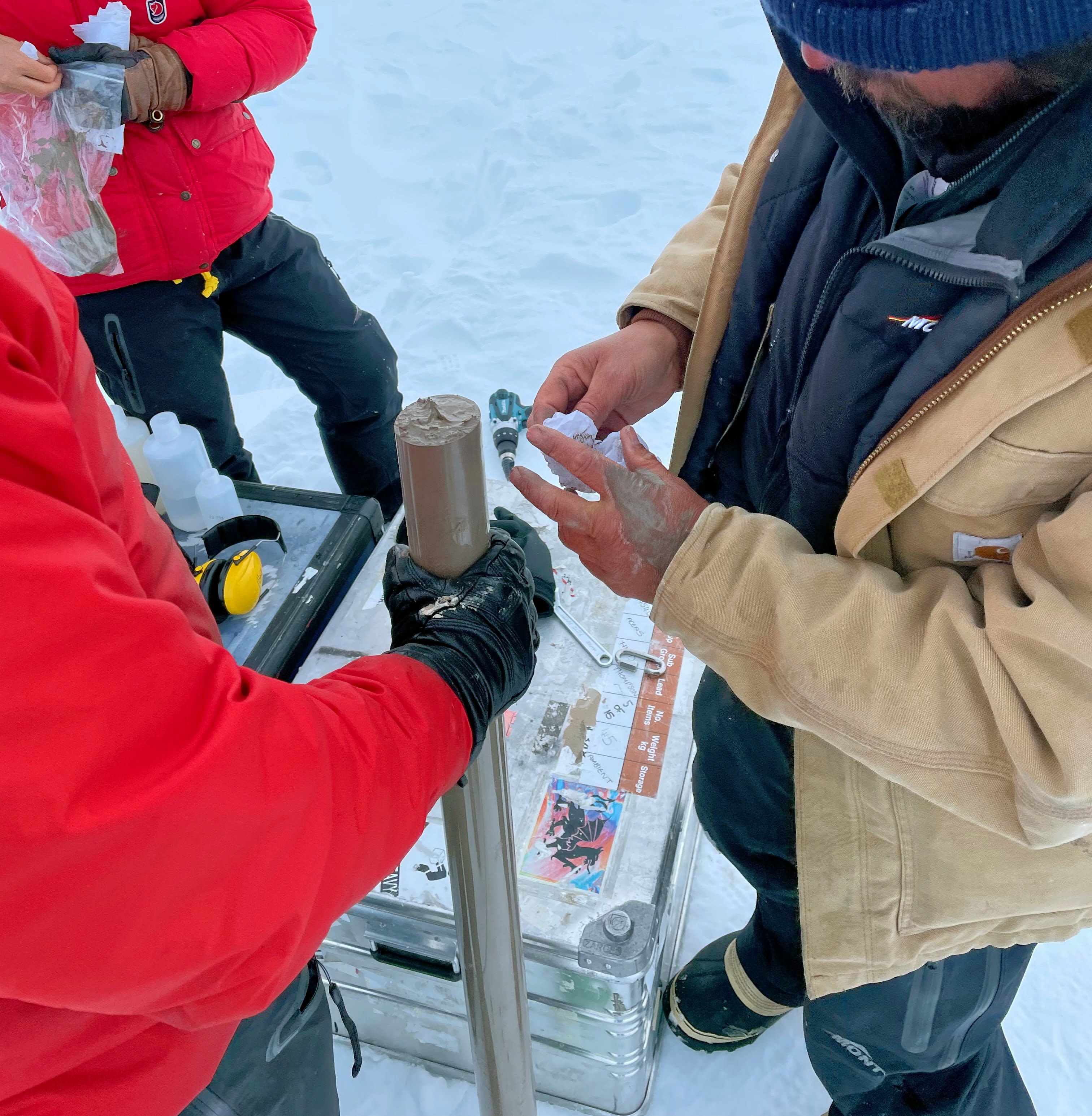
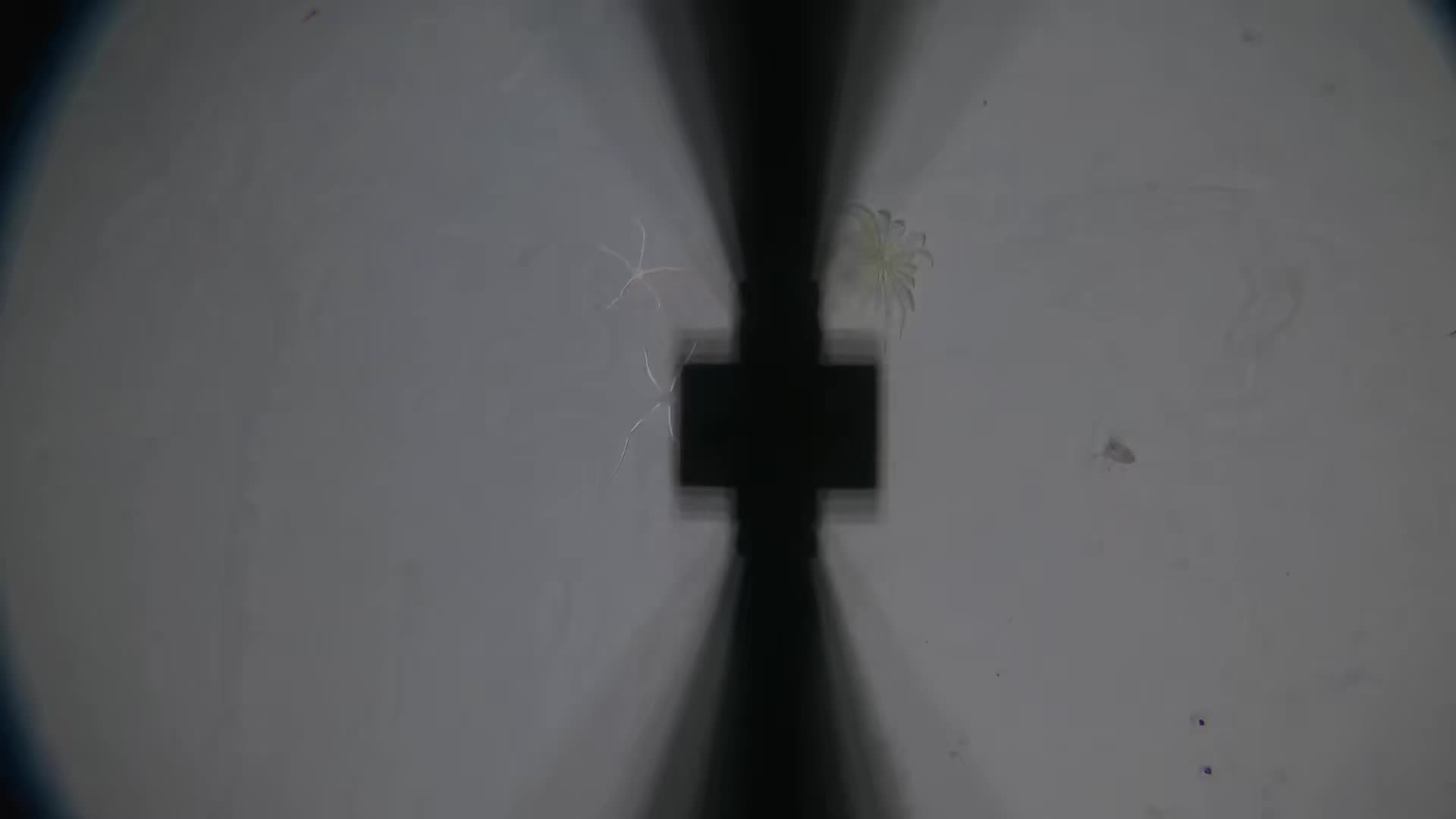
Another major achievement for the team was retrieving a sediment core from the ocean floor, although Sarah admits this was the one thing she wasn’t very confident about.
“We needed to get the corer down over one kilometre to the ocean floor and then all the way back up again without losing the sediment. But that’s exactly what we did. Twice!”
Duanne successfully retrieves a sediment core
Duanne successfully retrieves a sediment core
A sediment core from beneath an ice shelf is hugely valuable because it can reveal the behaviour of the ice shelf system over thousands of years into the past. Duanne will work with paleoceanographer Matt Jeromson to trace the chemical signatures of warm salty Circumpolar Deep Water preserved in the sediment.
Thanks to the CTD data, we now know that Circumpolar Deep Water is under the ice sheet. The sediments may reveal if this is a recent change or if it’s been there for a long time.
However, not everything went according to plan.
“We had designed a mooring — basically a string of ocean sensors that would hang in the ocean below the ice and record data for the next 2-3 years and send it back via satellite. Planning the deployment and buying all the sensors and other parts had been a huge job for me over 2023,” says Madi.
“Sadly we never managed to get it through the ice, we just couldn’t get the hole wide enough. Happily, we managed to recover the instruments. They’ll be deployed somewhere else in the future to collect critical ocean data beneath the ice.”
Sarah is already planning follow-up work for the next mission to the Denman Glacier, which will be a marine voyage on Australia’s national icebreaker RSV Nuyina planned for early 2025.
She says while there’s no hot water drilling on the ice planned for this Christmas, the system is being tested to make it easier to operate and drill through thicker ice.
“Next time it would also be great to have a bigger team to share the workload, particularly all the digging!”
Produced by Mark Horstman, June 2024
Australian Antarctic Program Partnership
University of Tasmania, Hobart
Imagery by Sarah Thompson and Madi Rosevear
Thanks to the Australian Antarctic Division and
the Denman Terrestrial Campaign, 2023-24
